This funny and inspiring post written by my adventurous sister is about her first solo backpacking trip through the Hoover and Yosemite wilderness. I loved reading it because I experienced many of the same things on my first solo trip, which you can read about here. Enjoy!
Day 1: Heading Out…Solo
It’s the perfect time for a backpacking loop! The season is ripe, my hubby is out of town and I have four free days on my calendar. What more can a girl ask for? Oh, I could ask for the beta on a sweet 46.8-mile loop backpacking trails in the Hoover and Yosemite Wilderness and great weather to go with it. Thanks to my girlfriend and the internet, I was the gifted with the first and the high-pressure gods for the second. The time is right indeed.
It’s 8:30 a.m. and with a fresh permit riding on my passenger seat, and lukewarm coffee in my bev holder, I’m cruising on Twin Lakes Road out of Bridgeport, California, to the trailhead. The Sawtooth Ridge is the predominate view out my windshield for most of the way until I’m almost to Twin Lakes, then it slowly falls from view behind a closer ridge-line. That’s okay; I’ll be seeing your pinnacled badass again in a few days. And much closer at that. The loop I chose, which is popularly known as the Benson Lake Loop, is, in fact, a lollipop consisting of 11.8 miles of stick (5.9 each way) and 35 miles of lolli.
Before I continue, I would like to interject that on this particular trip, I will be losing my proverbial wilderness virginity by doing it alone. I’m feeling anxious but only with the excitement I feel when I am about to explore an area I haven’t seen before. Don’t get me wrong, I fully expect that at some point that might change if I’m faced with an unsavory situation and I can’t turn to anyone and scream, “What that hell do we do?” But I’m willing to deal with that should the need arise. In fact, I think part of the reason I want this solo trip is not only for complete solitude but to see how I stand up to a “situation”. Will I be a brave-warrior-princess or a slobbering-puddle-of-crybaby? Oh, I hope I’m the princess.
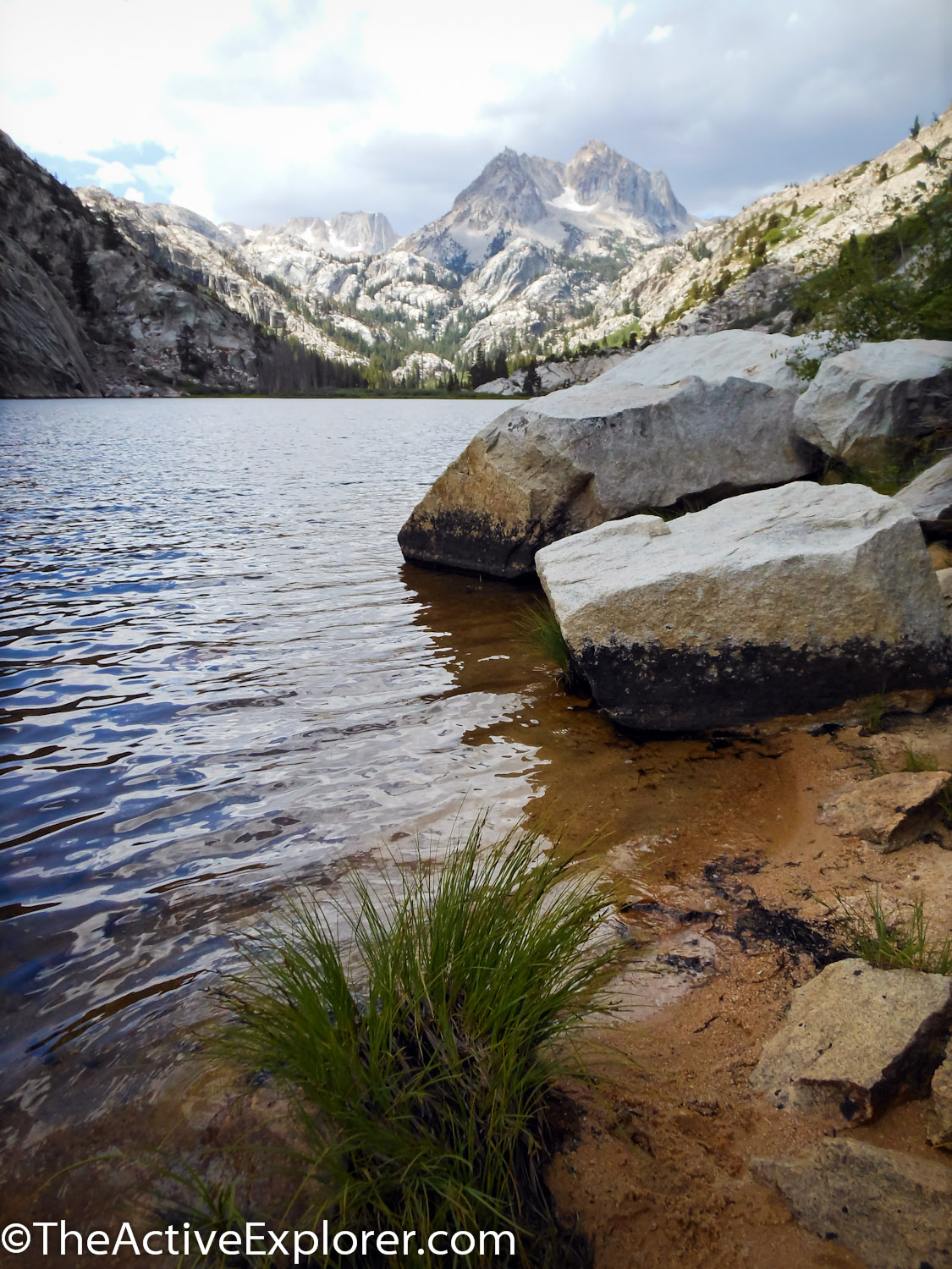
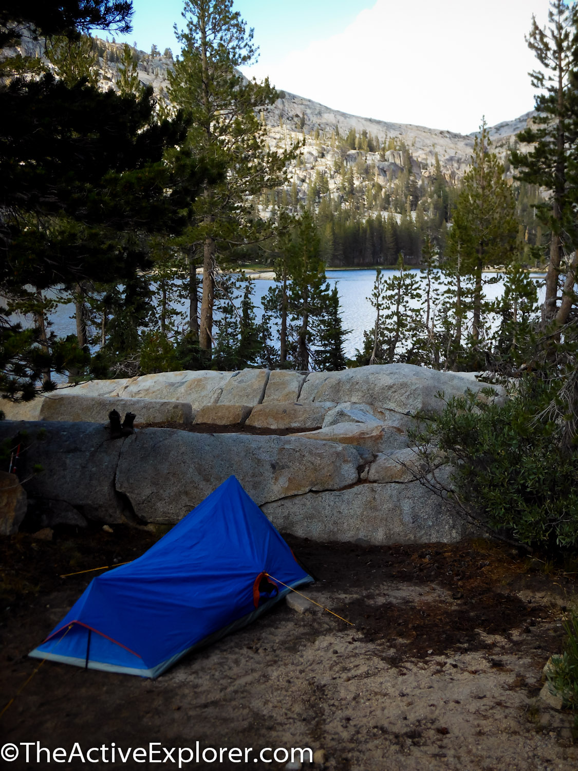
My starting point is at the southwestern end of Twin Lakes on the Robinson Creek Trail, elevation 7,092’, and my plan is to make it to Peeler Lake, only 7.1 miles and 2,397 feet into my future. It’s my easy day. The first couple of miles are flat meadow hiking, a great warm-up for the pending switchbacks. The granite on each side is high, steep and rich with the textures of erosion. There are a few switchbacks before I reach Barney Lake and I decide it’s a great place to grab a snack. I sit on Barney’s sandy shore and enjoy a million dollar view of Crown Point and a whole dog pile of cumulus clouds. Better get movin’. The trail leads me along the western shore of the lake and starts to ascend into deeper forest. I’m going up and up, fully engaged in switchback heaven, when the first raindrops fall. I pull on my bright green poncho and yellow backpack cover with black letters and laugh when I realize I must look like the Jamaican flag. No problem, I’ll just belt out a few reggae tunes and go with it. Light rain comes and goes my last couple of miles to Peeler and as I’m walking the parameter of the lake, looking for a site, I pass a troop of Girl Scouts. I start remembering the pledge I had memorized in elementary school when I was a scout and how we squealed and screamed on our campouts. I picked up my pace. Fifteen minutes later, I’m finally satisfied with the distance I put between myself and them and start constructing my domicile. The rain started again, harder this time. A flash and huge clap of thunder came along for the ride. Okay, what did I read about lightening? Let’s see. No tall trees, no water, no metal, no granite. Oh, I am so screwed, “What the hell do we do?” I screamed to the empty space next to me. Then I started slobbering.
Day 2: Lightning Safety and Pretty Views
After wiping off my chin, I pulled myself together and remembered the 30-second rule. When thunder and lightning are less than 30 seconds apart, it’s time to take action. In that case, I would need to make myself small and have as few contacts to the ground as possible. For instance, not sitting on my ass but crouching with a knee down for balance and definitely away from tall objects, water and metal. How long I could hold this position I don’t know but I would hold it through next Tuesday if it meant not having a billion volts surge through my body. So, I counted, 52, 53, 54. The numbers are good. I was safe for now. The thunderstorm eventually moved away and left a trace of clouds behind, the essential ingredient for a great sunset, and it did not disappoint. I watched the sky glow and listened to the scouts singing camp songs, their voices carrying across the still lake so clear and sweet I felt a bit guilty for my earlier snubbings. I slept great that night, my first night out alone, and I told myself I would face my next challenge with a little less slobber and a bit more warrior. Yeah right!
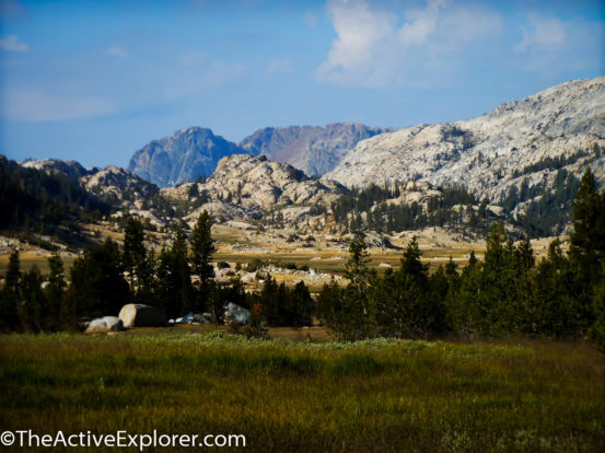
The next morning I said a thank you to beautiful Peeler Lake with its many campsites and rich acoustics and started the 15.3 miles to Smedberg Lake. Within minutes, I crossed the border from Hoover Wilderness into Yosemite, and quickly after that, I reached Kerrick Meadow. Dozens of cute little birds, let’s call them Kerrick Meadow chickadees since I have no idea what they really are, took over where the scouts left off, chirping and singing as I hiked along Rancheria Creek on a flat 6.8 mile stretch. Insane granite walls and belittling formations line my way. “Wow!” I said and turn towards the place where one of my girlfriends or husband would normally be. “Amazing!” I agreed, answering myself so the gesture wasn’t wasted. It may be my imagination but I think the chickadees just gathered up their young and moved to the other side of the meadow.
I reached Kerrick Canyon where I merged onto the Pacific Crest Trail, which I would follow for a little over 14 miles. I love it when random sections of the PCT extend into my route. I have been on so many bits and pieces of it I feel like it’s an old friend. I’m excited to see what my buddy has to offer this time. I reach Seavey Pass, which sits at 9,150 feet, and start a steep forest descent towards the Benson Lake junction. Once at the bottom I have a choice of taking the 1/2 mile trail to Benson and calling it a day or continue another 4.5 miles to Smedberg as planned. I decide to keep going. I need to cross a small meadow before starting my ascent and that’s when I encounter my first blowdown. Now I’ve had to scramble over fallen trees before but I have never encountered anything of this magnitude. The more I tried to stick with the trail it seemed the more I lost it. It’s like trying to find my way out of a game of pickup sticks only the sticks are 75-foot trees that created a labyrinth of obstacles. I have to keep retracing my steps to the last obvious place in the trail and figure out where it might come out on the other side, then find a way around the fallen giant to that spot. All I could see ahead of me were more fallen trees and I start to think I would have to stay at Benson and figure out a new plan. Just a few more and you’ll be out, I tell myself. Eventually my brilliant logic works (duh) and the trail finally opens up and I hike up to the base of Volunteer Peak and then to Smedberg Lake at 9,219 feet. I’ve never been so tired and every muscle hurts. Even the ones I didn’t think I was using. I have my choice of any one of the many great sites and promptly set up my tent, make a gourmet dinner on my tuna-can stove and drop into a coma for the next 10 hours. I guess 15.3 miles is a long day even for a brave warrior princess.
Day 3: Tune Worms and Sounds in the Dark
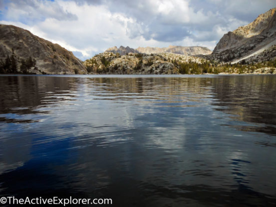
Smedberg Lake is a classic in its alpine fashion. Granite pours gently into the frigid water but never really disappears because the water is so damn clear. Pine, aspen and juniper are the trees, which bring the life, and character, that compliments the chiseled granite to its truest beauty. I want to linger but for now it’s goodbye and off I go on a 13.2-mile walk over two passes and up a canyon so spectacularly beautiful it’s still hard for me to believe I was lucky enough to pass through there.
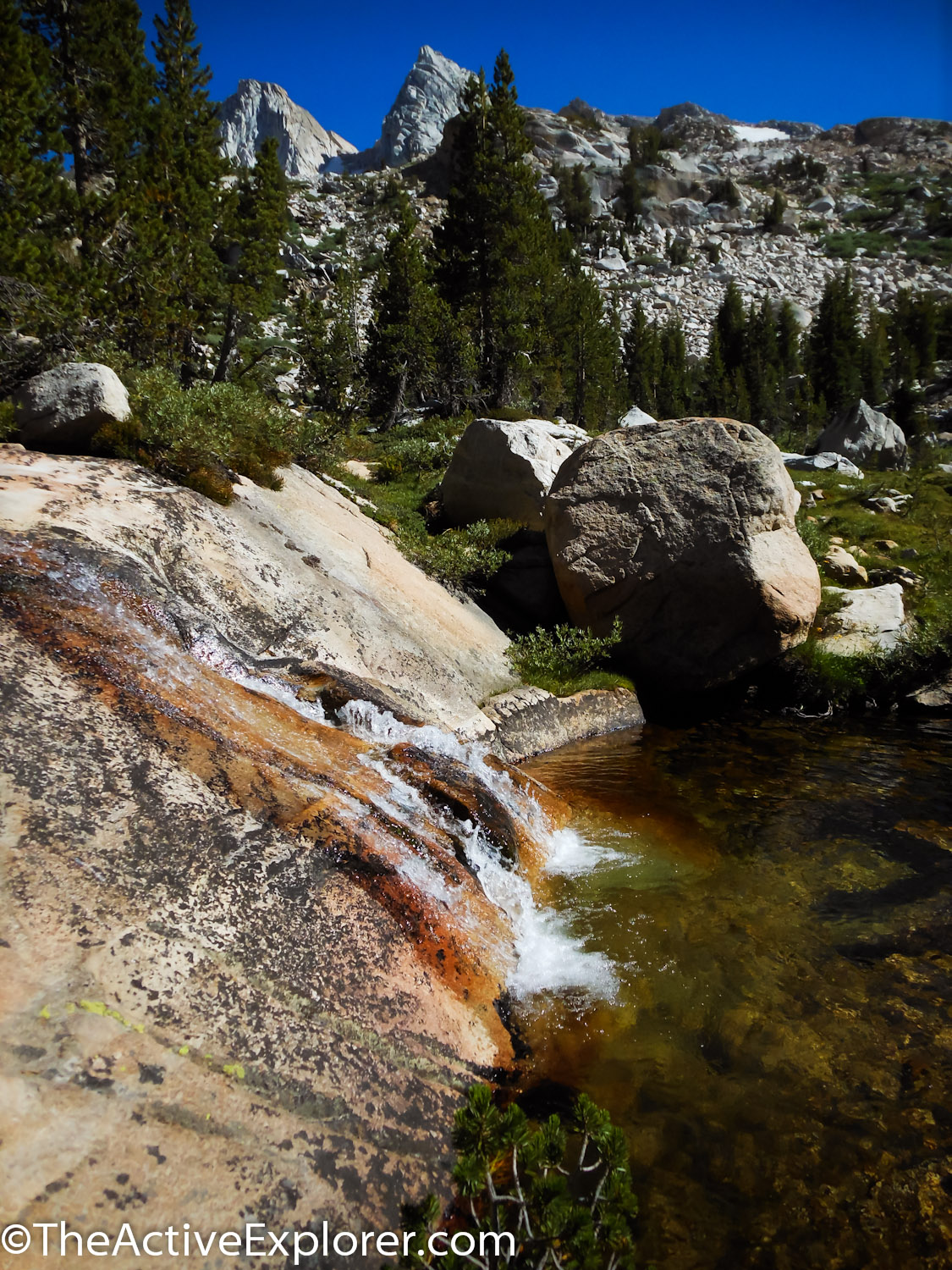
My day starts with a short but steep ascent onto a charming plateau, then over 10,100-foot Benson Pass and on to my 6.5-mile mark, which means the end of my affair with the PCT, for this trip anyway. This also means I’ll be dropping into the granite lovers wet dream that is Matterhorn Canyon, a beautiful glacially cut canyon that leads to Burro Pass. I gradually ascend for about 5 miles along Matterhorn Creek, at first shrouded by high, sloping granite walls then gifted with open views to the east of Whorl Mountain, Virginia Peak, and Twin Peaks, all of which are in the distinguished Over 12,000 Feet Club. To the north are Matterhorn Peak and the distinctly jagged Sawtooth Ridge. As luck would have it, I am traveling north so I get to view the Sawtooth directly before me as I travel. The climb becomes so steep the last mile or so up to Burro Pass I began to sing in my head the first song lyrics that I could think of so I wouldn’t focus on the loud protests coming from my legs, heart and lungs. “She’s a dancin’ dancin’ dancin’ machine. Watch her get down, watch her get down”. I don’t know any of the other words so those same lines loop and loop and loop until I reach the pass. Damn, it’s going to take a lot of work from the song fairies to pry that one out of my head. It could take days.
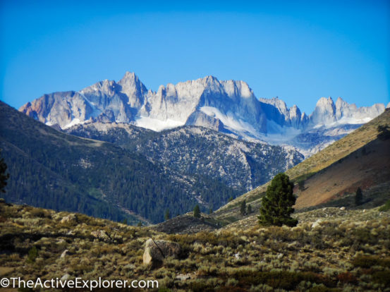
Burro Pass is an advantageously placed 10,650-foot cradle. I’m so close to the Sawtooth Ridge it seems I could heave a rock and unhinge a balancing granite boulder on its spine. And I’m surrounded in the best possible way. Spires, columns, peaks, slides, cleavers, buttes… It’s a grand buffet of granite formations. Lingering patches of snow are held in several areas and I try to imagine how insane this area must be to navigate in midwinter. I sit for awhile knowing at that moment I don’t want to be anywhere else and that I may never be here again. I turn to the empty space next to me to share my amazement but there was nothing but my pack. Oh, yeah, I forgot I am solo. I had better take some pics because there is no one to verify all this and as enthusiastic as I am right now it may end up sounding like a big fish story. Snap, snap and I start my descent.
I’m within two miles of my intended resting place, not at a lake this time, but alongside Piute Creek. After finishing my descent, I find myself hiking along the creek and start shopping for a perfect site. The first established site I come to is, in my opinion, too close to the water. I always try to follow the Leave No Trace 100-foot rule even if previous campers didn’t. The next site is too close to the trail to have the secluded ambiance I like. Good thing I have the extra energy to be picky! Site choice number 3 has too many fallen trees around it and several unhealthy looking branches hanging above. Because I don’t relish the idea of the wind picking-up and one of these trees taking the opportunity to get revenge on a member of the human race for past logging injustices, I walk away. Number 4 has a huge pile of bear scat. Yikes! Moving on. A quarter of a mile later I come across beautifully perfect lucky number 5. Cleared and level, no vengeful trees, no bear crap and a lovely protected swim hole in the close but not too close creek. And, holy smellsville, do I need a swim hole!
I collapse in my tent soon after the sunset and am startled awake by a sharp cracking noise. My heart starts to race as I imagine a branch collapsing under the weight of something enormous. I’m convinced it’s a bear. I feel for my headlamp and shine it out my tent door but it reflects off the screen and shines back at me so I can’t see a thing. I hear it again. I’m not sure but was that closer? Didn’t this bear get the memo that the bruin site is a quarter mile back? I had taken the steps to minimize my attractiveness to a bear. I set my bear canister way past the recommended distance of 200 feet and made sure it included my toothpaste and other scented personal care items. I even put in my minty floss just in case the bears in this area are prudent about their dental hygiene. I had made my dinner away from my site and washed out my pot even further away. “Hmmm,” I tilt my headlamp at an angle through the screen and I can see better into the night but it reveals nothing. Thirty minutes goes by and I’m pretty sure the batteries in my lamp are dimming and wouldn’t last until dawn when I would be willing to relax my present position. I take an inventory of my options. I can either go outside to my pack and retrieve my spare batteries or I can lay back down and try to sleep. Since I know damn well I’m not going out, I lay down and wish I hadn’t bathed. That would have kept all creatures away.
Day 4: Hiking Out and Sisterly Affirmations on the Trail
It took a while before I finally fell asleep but then I slept the rest of the night uninterrupted. Today is my 11.2-mile exit day. I’m sad because my loop is ending but I am also excited to see what the next 5.3 miles would reveal before I return to the “stick” of the lollipop, which I had already seen. I hoist my pack, much lighter now since most of the food is gone, and set off. The uphill onslaught hit quickly as I start a 1,000-foot ascent up to Mule Pass. I start wondering about the difference between mules and burros, but became bored of that and regress back to the musical brain-virus I’m still carrying compliments of the Jackson 5. “She a dancin’, dancin’, danciiiiin’. AAAAAH. I became certain that a lobotomy is my only way out. Gratefully, it isn’t long before the scenery starts to get my attention. The granite in this area is different than I’ve seen to this point. Instead of huge monoliths and walls, there are smaller boulders stacked and scattered about making the area look quaint. As if a little pika would pop its head out and squeak at me to get the hell out of his yard. By the way, if you have never heard of a pika, look up a photo on Google. They’re cute as a button (whatever that means because, frankly, I can think of many things that are cuter than buttons. But, whatever. I’m just conforming to the cliché).
When I reach the pass at 10,460 feet, there are two signs. One that says I am entering Hoover Wilderness and another tells me I am leaving Yosemite. I hang out for a while checking out the amazing views then start my descent. The switchbacks are steep, loose shale and next to an ice field, which I am hoping, I don’t have to cross at any point. But, all turns out well as I reach the bottom without incident and am greeted by Crown Lake. I don’t know if this lake has this surreal turquoise green color all year or if I am here at just the right time. Either way it’s a unique vision. The trail traces the northwestern edge of the lake then drops down to the pretty little Robinson Lakes. Shortly afterwards I reach the lollipop stick intersection and find a group of about a dozen young teen girls with a couple of adults kicking back against the rocks. One woman asks me where I’ve been. When I tell her that I am on the last 6 miles of a 46-mile backpacking trip, the entire group woots and claps enthusiastically while I stand there stunned and smiling at the unexpected outburst. The woman then asks me if I am alone. When I answer that, it’s my first solo trip the clapping and cheering resume, louder this time, and now I feel like a rock star. I even want to start clapping along with them but I thought that might seem inappropriate. Who are these chicks? Is there some kind of sisterly affirmation group having a field trip that I hadn’t heard about? Well, whoever they are I like them! I start an inquisition of my own and find out that they are, in fact, the Girl Scout troop who were my sunset serenaders at Peeler Lake three days before. Now I’m clapping and cheering for them and I walk away with a huge smile and a great ending for my adventure.
The Benson Lake loop turned out to be a perfect first time solo trip. The terrain is diverse, moderately challenging, and beautiful, beautiful, beautiful. I wonder when my hubby will be out of town next.
If you go:
- A permit for the Benson Lake Loop can be obtained for a song at the Bridgeport Ranger Station and Visitors Center in Bridgeport, Ca. However, when I started to sing they threatened to take it back if I didn’t stop.
- To reach the trailhead, take Twin Lakes Road out of Bridgeport for about 13 miles until you reach the Mono Village Resort. At the time of writing, the fee was $10 to park in their backcountry lot.
- The trailhead starts at the far end of the campground. Just ask at the info booth and they will point the way.
- A bear canister is required for this area.
- Always be a respectful steward of our wilderness areas and follow the rules for protecting them.
Comments 6
Great article and photos! Hoover & Yosemite Wilderness look awesome! Thanks for sharing.
Hi Laura,
Just curious what time of the year you did this loop? The article was published in early November so I assume the trip took place in Sept/Oct before too much winter set in?
Thanks
Mike
Hey Mike, I did that hike in late July. The weather was great. Brief Late afternoon thunder showers on two days but otherwise warm and sunny. ~ Laura
I enjoyed your write up immensely! I followed along on google earth. Last year i did the high sierra trail (5 nights) solo – first time. Loved it and was looking for my next trek. And now i have it! Perfect looking trip! Again, really appreciate the time you spent doing the write up and such. Safe travels to you! Jim – San Diego.
Thank you Jim! I hope you have a good trip when you go. Send me an update and picks perhaps:)
Hi, Jim; I hope you enjoy the Hoover trip as much as I did. I have the High Sierra Trail on my list. I can’t wait!